May 02, 2022
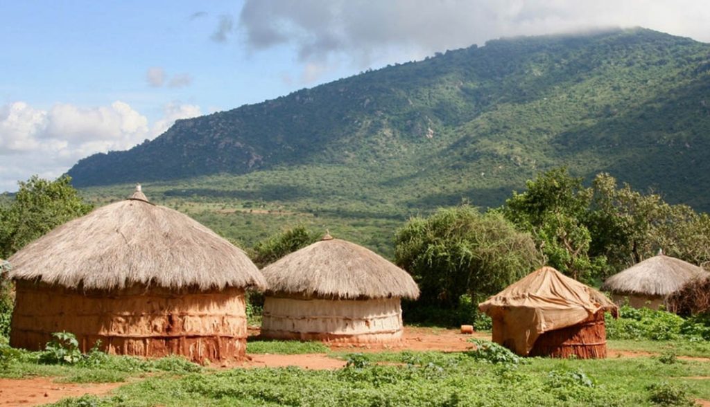
There’s a large swath of land in east Africa populated by homesteads known as bomas. While it’s estimated that more than a million Maasai people occupy this area, these bomas are made up of between 10 and 200 occupants, many of whom lack access to health care, education and clean water. The non-profit organization Humanity for Children (HFC) has resources such as mobile health clinics that could help, however some bomas are so remote, the group doesn’t know where to find them.
That’s where Mizzou Engineering comes in.
Keli Cheng, a PhD student in computer science, and Assistant Professor Grant Scott have devised a way to train artificial intelligence (AI) to identify bomas using Google Earth — a tough task for the human eye as the huts blend in with trees and other geographic features.

To apply machine learning, researchers manually scanned Google Earth imagery of Tanzania and determined criteria for positively identifying bomas and the fences that surround them.
“We used two types of data to train deep neural networks,” Cheng said. “Once the machine learned what bomas look like and what other parts to identify, we used it to rescan our map and get precise locations of bomas.”
The work is trickier than it sounds. Satellite images are captured from more than 300 miles above the Earth. That creates massive data sets that are far beyond a human’s ability to thoroughly review. That means Cheng had to train machine learning algorithms and apply geospatial AI components to produce maps from the massive collection of imagery, pinpointing exact locations of bomas across thousands of square miles.
Collaborators from the Center for Applied Research and Engagement Systems (CARES) at MU Extension stood up a specialized web mapping interface to deliver the geospatial AI results to HFC.
While the goal was to simply locate these homesteads, HFC President Bob Hansen said the work will have a greater impact. In addition to sending mobile health clinics to diagnose and treat prevalent diseases such as malaria, dysentery and HIV, the organization can now focus on intervention and education.
“When we showed our Tanzania colleagues the map that Mizzou Engineering researchers created by applying AI to the satellite maps, they were absolutely amazed by the number of bomas and their distance from clinics and schools,” Hansen said. “We are now taking each of the bomas that the researchers identified and sending our staff to travel there by motorcycle or foot to interview people regarding health and education. By working together, we are creating a demonstration project that can be duplicated in other remote areas, whether they are in Africa or other places around the world.”
And it demonstrates the power of engineering research.
“This is a great opportunity to show how geospatial AI systems can be developed and leveraged to benefit humanity, even half a world away,” Scott said. “Keli’s work is a wonderful example of how our exceptional graduate students are creating impactful research with international implications.”
The research team published their process and results in IEEE Journal of Selected Topics in Applied Earth Observations and Remote Sensing last month. Co-authors include Lincoln Sheets from the Department of Health Management & Informatics, as well as Ilinca Popescu, a Stanford University undergraduate student who resides in Columbia.
The work is funded entirely by Dr. Scott’s internal research development funds.
Conduct research that changes the world. Become a Mizzou Engineer!